Field Projects Previous
Kura-Arax depression and Vorotan River Valley
Location: South Caucasus
Cronology: Pleistocene
Director: L. Asryan and A. Ollé
Searching for the Pleistocene Hominin Occupation in the Kura-Arax depression and in the Vorotan River Valley (South Caucasus)
The Caucasus region is recognized as one of the most important transit and inhabiting areas for hominin and animal populations during the Pleistocene. The famous site of Dmanisi (Georgia) that provided the oldest human remains of Eurasia (ca. 1.8 Ma) is located in the Caucasus. The discovery of the Dmanisi burial chamber leads to think that sites of similar antiquity could be found in this region, enabling the study of human evolution in their dispersal from Africa to Eurasia.
This idea has stimulated the development of a series of geo-archaeological surveys, excavations and multidisciplinary research throughout large area of the South Caucasus (Lesser Caucasus). However, most of the research has been concentrated in the northern and central part of this region, i.e. in the areas close to Dmanisi (e.g. the Lori-Shirak depression, the Debed River basin, the Ararat Valley and the Hrazdan-Kotayk plateau). The southernmost part of the South Caucasus has been studied in lesser degree, even though this area is in the centre of the so-called "Transcaucasian Corridor".
To date, there are no exhaustive surveys of new archaeological sites or detailed geological maps of the southern part of the Lesser Caucasus in general, and of the Kura-Arax River depression and the Vorotan River basin in particular (the territory between Armenia and the Artsakh region). This seriously limits the interpretation of the existing data and its further correlation with what is known from the northern part of the South Caucasus.
For this reason, the main goal of this project is to begin a systematic archaeological survey programme in the area between the Kura-Arax depression and the Vorotan River basin. This will enable to create an initial inventory of prehistoric archaeological sites and place them in a geomorphological context. Moreover, this will provide important data on human and faunal migration through the "Transcaucasus Corridor" during their out-of-Africa dispersal. At the same time, the involvement of international and national teams within the framework of the same project will bring quality to local science. This will include the participation of local students and their training in different branches of archaeology (something that is much needed in this region) as well as new lines of collaboration between participating teams.
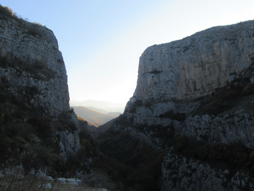
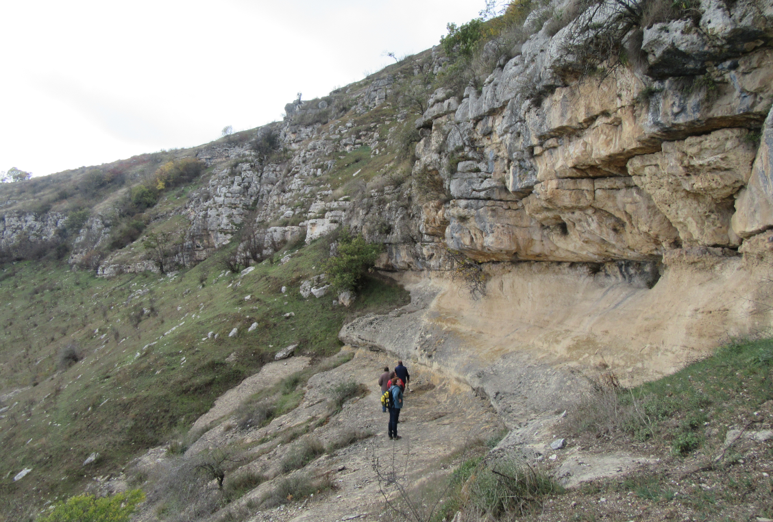
With these goals in mind, the first short field-season of the project was organised in November of 2019. This consisted of surveys of large areas, such as river terraces, karst and volcanic formations, in search of localities that could host archaeo-paleontological deposits.
As for the specific results of this field-season, a journey of about 500 km was made through the valleys of the Karkar, Khachenaget, Tartar and Aghavno rivers (which flow into the larger rivers of Kura, Arax and Vorotan) thus visiting some of the river terraces, limestone and volcanic formations in five of the seven distinct regions of the study area. Some potentially good areas for archaeo-stratigraphic surveys were documented in the visited areas. In addition, six areas were documented in the Karkar, Khachenaget, and Aghavno River Valleys for systematic surveys during the upcoming field-seasons.
The overall balance of this first visit to the study region is highly positive. Although the field-season was very short, the objectives proposed initially have been satisfactorily achieved. We have confirmed the feasibility of the project both at an organizational and scientific level. The bases for the further development of the project’s organisation (administration, collaborators, etc.) were laid and the following scientific actions have been set. This consists of carrying out two archaeo-geological trenches and surveying, at least, in six different areas of interest during the upcoming field-seasons.
 Caucasus map with some of the Pleistocene important sites (Dmanisi, Nor Gehi, Aghitu – 3 & Azokh) and the location of the interest area (highlighted in yellow)


Situació:
South Caucasus
Cronologia:
Pleistocene
Direcció:
L. Asryan and A. Ollé
Localització:
International
More images: